How NASA Uses American Deserts To Prepare For Mars Expeditions
When NASA's Perseverance rover left Earth on July 30, 2020, it faced a 293-million-mile trip to a planet where nobody could fix it if something broke. Mars isn't just a long way away; its environment is also extremely hostile. Temperatures average around -80 °F, its air is 95 percent carbon dioxide, and a radio command sent from mission control can take 20 minutes to arrive.
That's why the space agency gets in plenty of practice first, ironing out the wrinkles before catapulting equipment like Perseverance into space. It's also why so much of that practice happens in America's deserts.
Death Valley National Park, California

The National Park Service (NPS) lists 134 °F as the highest air temperature ever recorded on Earth. That extreme heat was measured at Furnace Creek in July 1913, and while the warmest days on Mars only reach 70 °F, in most other ways Death Valley National Park is a close match to the red planet: bare rock, salt flats, sand dunes, and less than two inches of rain in an average year.
NASA has been testing in Death Valley since the 1970s, when it was preparing the twin Viking landers for its first Mars landings in 1976. It was time well spent with the mission being successful, and the pictures Viking sent back showing a rubble-covered plain much like the boulder-strewn basalt mound beside Badwater Road now known as Mars Hill.
The testing continued in 2019 when engineers flew a camera-based landing system over the park on a helicopter, and two years later, the same system steered the Perseverance rover to a safe touchdown. Further tests followed in 2025 with NASA's Jet Propulsion Laboratory (JPL), the California center that builds the agency's Mars rovers, flying three research drones over Mars Hill and the Mesquite Flat Sand Dunes.
They were working on a problem that came from Mars itself. Ingenuity, the small helicopter that made 72 flights there, had trouble navigating over smooth, featureless sand, and the Death Valley flights tested software meant to fix it. It was only the third time research drones had been licensed to fly in the park. At the north end of the park, an hour's drive from Furnace Creek, Ubehebe Crater is 600 feet deep and half a mile wide and was formed when rising magma met groundwater and turned it to steam. The clay at the bottom resembles the mudstone that the Curiosity rover studied in Gale Crater on Mars.
The Mojave Desert, California

Curiosity weighs 1,982 pounds on Earth but only 750 pounds on Mars, where gravity is 38 percent as strong. So, before the rover landed in August 2012, NASA built a 750-pound copy of it to find out how its wheels would behave on Martian sand. The copy has the same wheels and suspension as Curiosity, but no onboard computer, which is why engineers named it Scarecrow: it has no brain.
In May 2012, three months before the landing, they took Scarecrow to Dumont Dunes, a 7,620-acre off-road riding area north of Baker in the Mojave Desert. The dunes were picked because sand like this was waiting near Curiosity's landing site, and the team drove Scarecrow up and down the slopes to find out what the real rover could and couldn't climb.
Rover rehearsals in the Mojave Desert go back even further. In February 1999, scientists at NASA's Ames Research Center in northern California spent two weeks commanding a Russian-designed rover on Silver Lake, a dry lakebed in the Mojave, working only from the pictures and data it sent back, just as they would on Mars. It covered 295 feet in total.
In April and October, a prototype called FIDO used the same lakebed to rehearse for the Spirit and Opportunity rovers.
The desert also supplies NASA with its Martian dirt. No soil has ever been brought back from Mars, so engineers found a substitute in a quarry on Saddleback Mountain. They discovered that basalt from 20-million-year-old lava flows crushes into a close match for the soil on Mars. The same material was later used to test the drill on the Perseverance rover.
The Mojave is also where NASA listens. The Goldstone Deep Space Communications Complex near Barstow is one of three stations worldwide that receive data from Perseverance, and its largest dish, 230 feet across, is nicknamed the "Mars antenna."
Black Point And Flagstaff, Arizona

Every astronaut who has ever walked on the Moon trained first in the volcanic country around Flagstaff. The same lava fields are in use once more, and this time the destination is the Moon first and Mars after it. The main test site is Black Point Lava Flow, a tongue of black basalt 40 miles north of the Arizona city that erupted 870,000 years ago.
NASA's Desert RATS program, short for Desert Research and Technology Studies, was formed in 1997 to test spacesuits, rovers, and habitats on rough ground, and Black Point is ideal for the job.
In 2010, two rovers the size of pickup trucks, each crewed by an astronaut and a geologist, spent 14 days crossing the lava. These and other rehearsals are aimed squarely at the Moon, which NASA describes as a stepping stone to Mars, so rovers and suits are tested with both destinations in mind.
Mars has had rehearsals of its own here. For ten days in August 2002, more than 60 scientists at JPL in California steered a test rover called FIDO around a patch of Arizona desert without being told where it was, so they had to rely on its cameras alone. JPL later named the site Grey Mountain, and the exercise trained the team that went on to run the Spirit and Opportunity rovers.
Flagstaff also played a role in helping the Perseverance rover land. The USGS Astrogeology Science Center, based in the city since 1963, made the two maps of Jezero Crater that the rover's computer compared with its own camera views on the way down. The center's scientists also study the Grand Falls dune field, 43 miles northeast of Flagstaff on the Navajo Nation, because its sand is basalt, like most Martian dunes.
Walker Lake, Nevada

For two weeks in February 2020, seven scientists in the Nevada desert pretended to be a robot. They were standing in for NASA's Perseverance rover, then five months from launch, and between them they carried hand-held versions of its instruments: cameras, an X-ray tool, a laser, and a ground-penetrating radar pushed along in a jogging stroller.
The site was a dry lakebed beside Walker Lake, chosen because it matched the rover's destination. Perseverance was headed for Jezero Crater, a 28-mile-wide basin that had a lake and a river delta 3.5 billion years ago, so the team needed an old lake of its own. Walker Lake is a remnant of a much larger prehistoric one, Lake Lahontan, and has dropped more than 150 feet since 1882.
The exercise ran like the real mission. Another 150 scientists around the world sent the field team commands and waited for the pictures and data to come back, as they would with the rover on Mars. To keep the remote team honest, the location was kept from them, and the field crew swept away their own footprints with a broom so nobody could use them to judge the size of the rocks.
It paid off. In the dried mud, the team found stromatolites, layered rocks built up by microbes, which are the kind of fossil Perseverance was sent to look for.
Hanksville, Utah

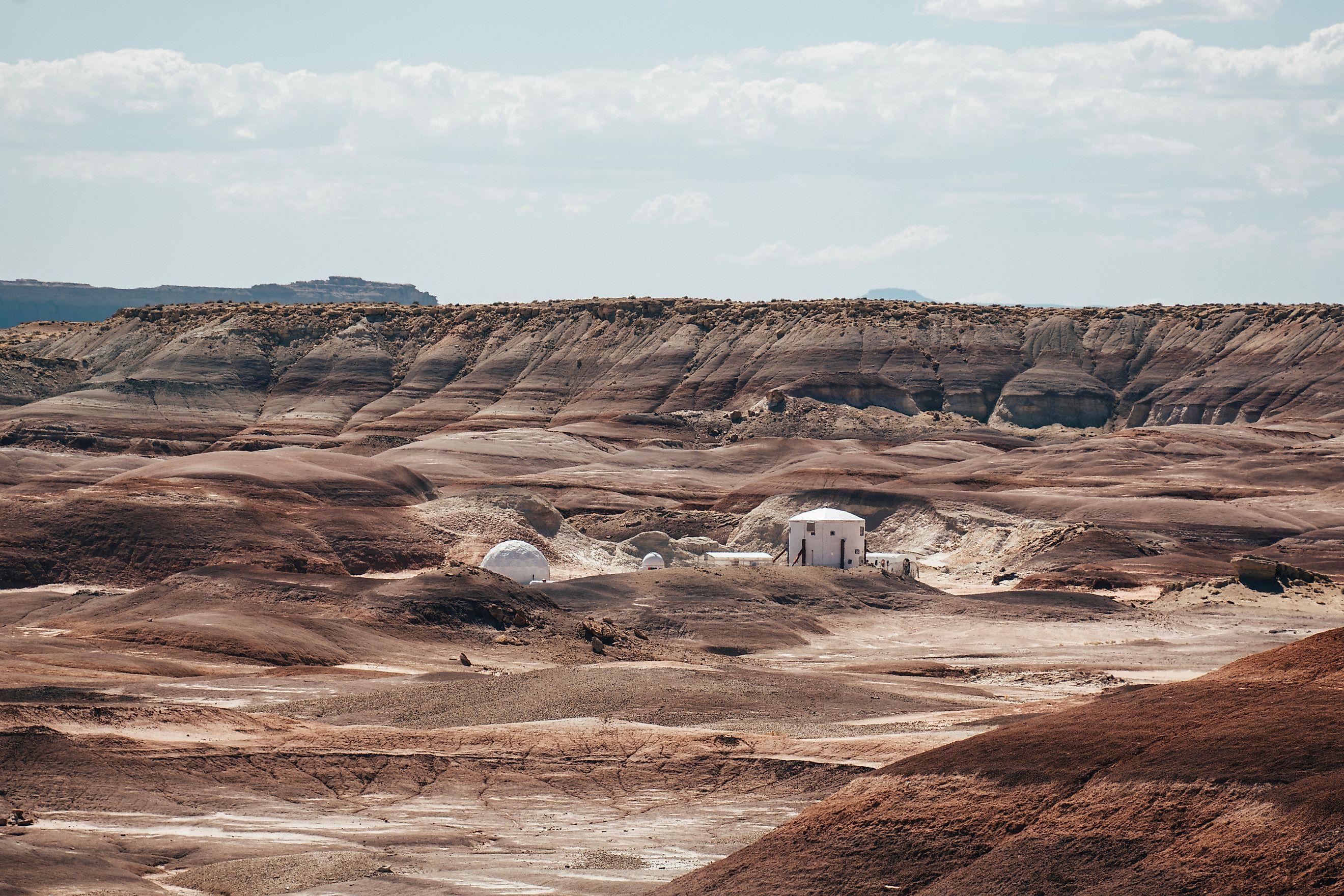
The ground around Hanksville, Utah, looks like Mars because it formed the same way. Rivers that flowed here 150 million years ago left sandy beds that hardened into sandstone; the softer ground wore away, and the old channels now stand above the desert as winding ridges. NASA has photographed the same upside-down riverbeds on Mars.
That resemblance is why the Mars Society, a nonprofit that campaigns for human missions to the planet, opened the Mars Desert Research Station here in 2001. Crews of six or seven spend two weeks in a two-story cylinder 26 feet across and make 400 gallons of water last the whole stay.
NASA has borrowed the station more than once. In April 2005, 18 of its scientists and engineers spent two weeks there testing a communications system for astronauts in spacesuits, and in November 2009 a NASA-led crew tried out a robotic soil sampler called the Mars Underground Mole. Jessica Watkins, chief geologist on a crew that same year, went on to become a NASA astronaut.
White Sands And Potrillo, New Mexico

White Sands National Park stands in for Mars for one reason: its sand. Its 275-square-mile gypsum dunefield is the biggest in the world, according to the National Park Service, and its Martian counterpart is Olympia Undae, a field of gypsum dunes circling the planet's north pole.
In August 2025, a NASA-funded project called LASSIE spent five days here teaching a four-legged, dog-like robot to cross loose sand, and for the first time it made its own decisions. With temperatures in triple digits, testing started at sunrise.
NASA's ties to the area go back further. Its White Sands Test Facility near Las Cruces opened in 1963 to test Apollo engines, and in 1972 engineers there fired the Viking lander's descent engine over simulated Martian soil to see what its exhaust would do to the surface.
Southwest of Las Cruces, the Potrillo volcanic field covers more than 400 square miles of cinder cones, lava flows, and craters, and NASA treats it as a stand-in for volcanic ground on both the Moon and Mars.
In June 2017, a team from its Goddard Space Flight Center spent ten days there testing hand-held instruments for future astronauts. Among the field's craters is Kilbourne Hole, 1.7 miles long, where Eugene Cernan and Harrison "Jack" Schmitt trained in December 1971, a year before their Apollo 17 moonwalk.
Next Stop... Mars!

While none of these deserts is a perfect copy of Mars, they do provide places where NASA can make mistakes cheaply. A rover that bogs down at Dumont Dunes can be towed out, and a scientist who misreads a rock at Walker Lake can go for another look. On Mars, 140 million miles away, neither is possible.
NASA calls Mars its "horizon goal" for human exploration and is working to send astronauts there as early as the 2030s. It'll be a trip that's expected to keep them away for three years. Before that can happen, the spacesuits, the rovers, and the crews themselves will be tested in America's deserts, just as they have been since the 1970s.